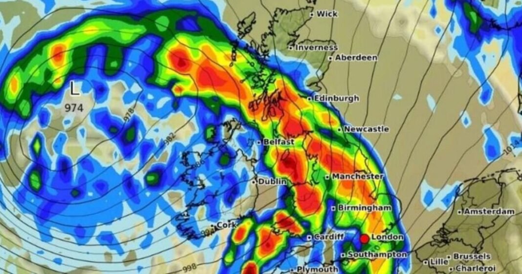
The United Kingdom is bracing for a significant rainstorm approaching in the near future, as weather forecasts pinpoint the exact timing and locations of the downpour. According to maps provided by WXCharts, a large swath of rain spanning 630 miles from Scotland’s Hebrides to southeast England is expected to move across the country on Sunday, September 14.
In England, heavy rainfall is anticipated to commence around 9 am on Sunday, soaking major cities like Manchester, Newcastle, Birmingham, Southampton, Plymouth, and London. Manchester could experience rainfall rates of up to 5mm per hour, while Newcastle may see around 2.5mm per hour.
Wales is also in line for rainy weather, with Cardiff likely to encounter up to 1mm per hour of rainfall. In Scotland, Edinburgh is predicted to face the most intense rain, with rates reaching up to 5mm per hour.
Although parts of the Scottish Highlands may initially escape the worst of the rain, the precipitation is expected to move northwest by midday. Northern Ireland, particularly Belfast, is set to receive the heaviest showers, with an estimated 1mm per hour of rainfall.
The Met Office has issued a yellow weather warning due to severe winds forecasted to reach up to 80mph. This alert covers a significant portion of western and southwestern England, Wales, and the southern English coast, effective from 8 pm on Sunday until 6 pm on Monday.
Residents in the affected areas are advised to secure loose items around their homes to prevent potential injuries from flying debris. The warning highlights the risk of injuries and life-threatening situations.
Damage to buildings, coastal towns facing spray or large waves, and potential travel disruptions, including road and bridge closures, are expected. Power outages are also a possibility, which could impact services like mobile phone coverage.
To stay safe during the storm, the Met Office recommends staying indoors whenever possible. If going outside is necessary, individuals should avoid being near buildings and trees and should refrain from unnecessary driving.
Chief Meteorologist Paul Gundersen stated that a deepening area of low-pressure over the North Atlantic may bring impactful weather to the UK over the upcoming days, with the likelihood of a named storm currently low.
Looking ahead, the Met Office’s forecast from Friday to Sunday includes a mix of sunny intervals and blustery showers, with some heavy showers possibly accompanied by hail and thunder. More continuous rain is expected to arrive on Sunday, with cooler temperatures prevailing.
In its extended forecast covering September 10 to 19, the Met Office anticipates unsettled weather patterns dominated by low pressure for much of this period.

